Ask something a method can answer
“Is this island healthy?” is an important concern but an imprecise field question. Health could refer to breeding success, habitat extent, water quality or the absence of introduced species. A workable investigation identifies a measurable variable, a defined place and a relevant timescale. For example, a study might compare visible vegetation cover among authorised survey plots. That narrower question does not measure every aspect of ecosystem condition, but it creates a clear connection between evidence and claim.
Educational participation begins by understanding that connection. You can analyse published counts, practise recording observations from a permitted path or review sample photographs without collecting anything. Handling animals, removing organisms, deploying sensors or entering restricted plots belongs within an approved project. An interesting question does not replace landowner permission, research ethics review or practical competence.
Design the comparison before taking measurements
Convenient sites are not necessarily representative sites. If all your observations come from sheltered ground near a landing place, they cannot automatically describe exposed cliffs or distant uplands. Formal studies use sampling designs chosen for their question and constraints. Random, systematic and stratified approaches address different problems, and each still depends on access, safety and ecological sensitivity.
Replication also needs care. Several photographs of the same patch are not equivalent to observations from several independent patches. Repeated measurements may help estimate recording error, while independent sites help investigate spatial variation. A learner should ask what the actual unit of comparison is before interpreting a chart. The answer often matters more than the number of rows in a spreadsheet.
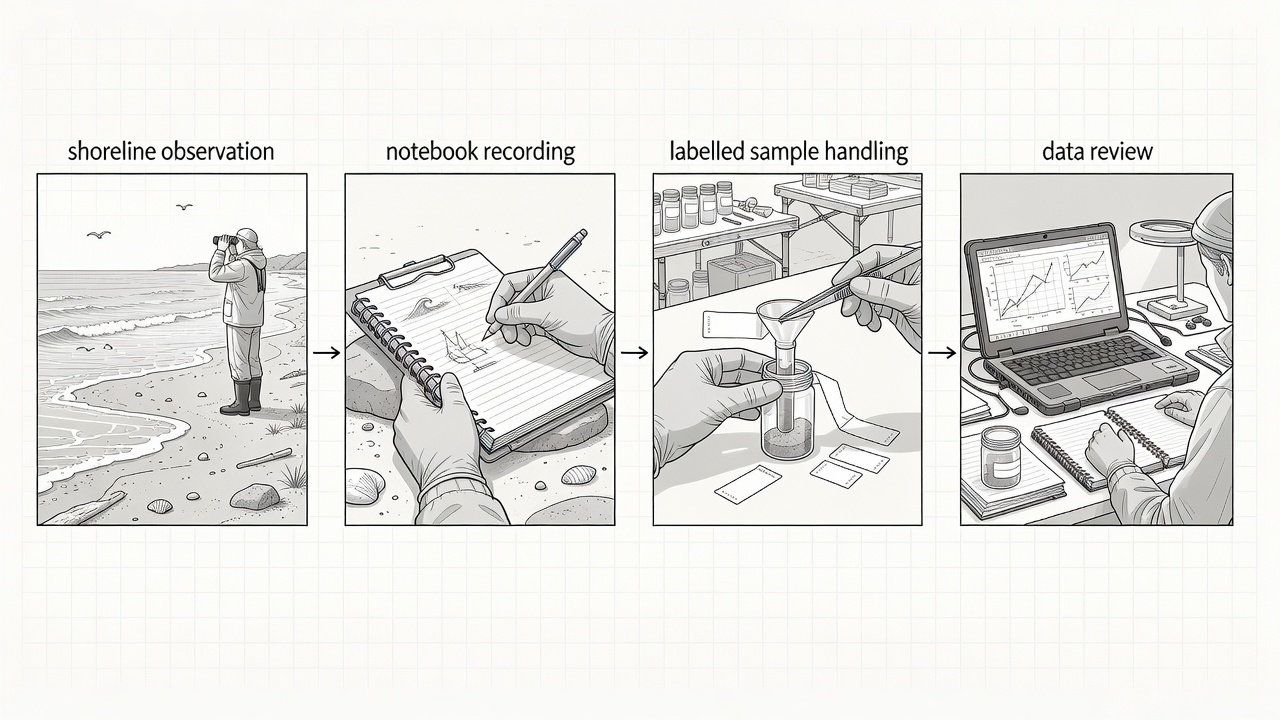
State the variable, scope and permitted setting.
Keep observations and metadata together.
Check gaps, inconsistencies and limitations.
Choose a method with visible limits
Different tools make different parts of an island legible. A photograph preserves visible detail but may hide scale or changing light. A count describes detected individuals, not necessarily the entire population. A water sample captures a particular place and time and may be altered by contamination or storage. Combining methods can be useful, but more equipment does not automatically create stronger evidence.
| Method | Useful for | Important limitation |
|---|---|---|
| Fixed-point photograph | Visible habitat change | Viewpoint, season and light must be comparable |
| Standardised count | Repeated observations of detectable animals | Detection changes with weather, behaviour and observer |
| Water sample | A defined chemical or biological analysis | Containers, contamination and handling affect results |
| Instrument record | Measurements across time | Calibration, power loss and sensor drift need checks |
Make metadata part of the observation
A number without context is difficult to interpret. Useful metadata can include the observation time, location reference, observer, method version, units, equipment identity and relevant conditions. Sensitive locations may need controlled access rather than public coordinates. Keep a record of corrections instead of silently overwriting an original entry. If a value is missing, say so; inventing a plausible replacement conceals uncertainty.
The FAIR principles provide a useful introduction to making data findable, accessible, interoperable and reusable. FAIR does not mean that every dataset must be freely downloadable without restrictions. Ethical, conservation and legal controls can coexist with clear documentation. The British Antarctic Survey Polar Data Centre and the Scientific Committee on Antarctic Research offer routes into established polar data practices, rather than shortcuts around project governance.
Make uncertainty visible
Uncertainty has several sources. An instrument may have limited precision. A bird may be hidden behind terrain. Different observers may classify vegetation differently. Weather may prevent a planned visit. Describe these constraints where they affect interpretation, and avoid reporting more decimal places than the method supports. A clear statement of limits is more useful than an appearance of precision that the measurements cannot justify.
Long-running observations, such as those supported through the New Zealand Department of Conservation on subantarctic islands, show why continuity matters. A single educational visit cannot reproduce the context of a managed monitoring programme. It can, however, teach the habits that make monitoring interpretable: consistent definitions, documented effort and respect for the distinction between an observed result and an inferred explanation.
Finish with a traceable account
At the end of a learning exercise, retain the question, method, observations and limitations together. Include a brief note on what you would change next time. Do not claim that your activity contributed to a research programme unless the programme has actually accepted it under its own protocol. Citizen science can provide a legitimate route to participation, but a named project, explicit instructions and a quality-control process matter more than the label.
Good field evidence is a chain of decisions that another person can follow. Understanding that chain is valuable even when you never set foot on a remote shore. Published datasets, archived images and well-described methods allow serious learning from home, without creating new pressure on wildlife or on the people who maintain remote research environments.
Next: the working station